
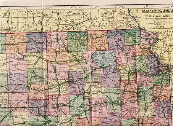
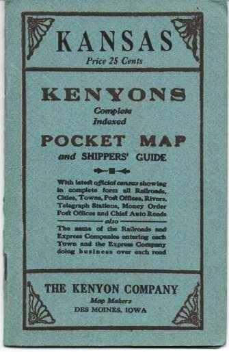
KANSAS: Kenyon's Complete, Indexed Pocket Map and Shippers' Guide; With latest official census, showing in complete form all Railroads, Cities, Towns, Post Offices, Rivers, Telegraph Stations, Money Order Post Offices, and chief Auto Roads. Also the name of the Railroads and Express Companies entering each Town and the Express Company doing business over each road.
Des Moines, Iowa: Kenyon Co., Map Makers, (1916). 1916 edition. Printed Stiff Wrappers. (26)pp text. Full-color map, folded inside card covers, opens to 15" x 20". Blue card covers, printed in black. Fresh, clean condition. 6.25" x 4" Fine. Item #037641
[WorldCat locates four holdings of this map: Princeton, Yale, U Missouri-KC, U Kansas. Decker 22:227--1883 edition.].
Price: $125.00
See all items in
American West,
Maps
See all items by Kansas