![Item #038383 THE RAND-McNALLY VEST POCKET MAP OF ILLINOIS:; Showing all Counties, Cities, Towns, Railways, Lakes, Rivers, etc. Population is given according to the latest official census. [cover title]. Illinois.](https://petrillabooks.cdn.bibliopolis.com/pictures/038383.jpg?width=768&height=1000&fit=bounds&auto=webp&v=1535398750)
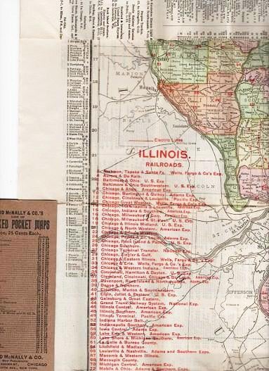
THE RAND-McNALLY VEST POCKET MAP OF ILLINOIS:; Showing all Counties, Cities, Towns, Railways, Lakes, Rivers, etc. Population is given according to the latest official census. [cover title]
Chicago and New York: Rand McNally & Co., (1909). 1909 edition. Original Wrappers. Full-color map opens to 26" x 17", statistics printed on verso. Folds into tan stiff wrappers, printed in black. 5.5" x 2.5" Very Good. Item #038383
Price: $45.00
See all items in
Maps,
USA-State by State
See all items by Illinois