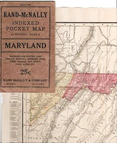
RAND-McNALLY INDEXED POCKET MAP AND SHIPPERS' GUIDE OF MARYLAND AND DISTRICT OF COLUMBIA:; Railroads, Electric Lines, Post Offices, Express, Telegraph and Mail Service. Counties, Municipal Townships, Cities, Towns, Villages, Islands, Lakes Rivers, Creeks, etc. Population according to the latest official census.
Chicago and New York: Rand McNally & Co., (1916). 1916 edition. Original Wrappers. pp: 42, (4) hotel ads. Full-color map opens to 21" x 27.5". Folds into tan stiff wrappers, printed in black. First leaf has a full-page ad for "160 Acre Farms in Western Canada--Free." 6.5" x 4" Very Good. Item #038375
Price: $75.00
See all items in
Maps,
USA-State by State
See all items by Maryland