HAND-COLORED FOLDING MAP OF OXFORD, NAUGATUCK, MILLVILLE & STRAITSVILLE, CONNECTICUT
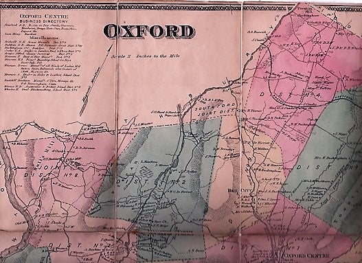
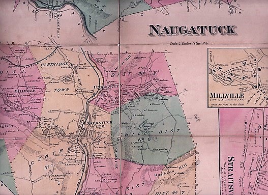
s.l. s.n., circa 1850s? Original document. Engraved map, colored by hand in pink, green and yellow; mounted on canvas in panels for folding. Opens to 15" x 24". Folds to 7.5" x 4". Trace of light wear at folds, still in sound condition. Shows rivers, railroads, major property owners, etc. Printed in an upper corner is an Oxford Centre Business Directory keyed to the map. Entries include: Sanford, S.P., Dealers in Dry Goods, Groceries, Hardware, Drugs, Hats, Caps, Boots, Shoes, Liquors, &c.; Henry Lum, Resident; G.R. Baldwin, Mason; O.C. Buckingham, Butcher; Alfred Harger, County Surveyor; R,S, Hinman, Principal, Boarding School for Boys; Horace Hinman, Mfr. of All Kinds of Ladies Kid Button Boots, Batmorals, also Gaiters of Cloth, Morocco, &c.; etc., etc. Very Good. Item #040571
Price: $100.00